





Oil and Gas
4D Digital Twin for Oil&Gas Facility Management
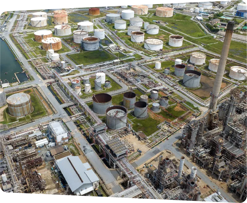
The modern Oil & Gas industry relies on sophisticated facility management to ensure seamless operations of critical infrastructure. These facilities, which handle complex processes and hazardous materials, require meticulous oversight to maintain productivity while meeting stringent safety and environmental standards.
Request Demo
Challenge
What makes Oil&Gas Facility Management challenging?
Creating and maintaining accurate facility documentation is critical yet complex in oil & gas environments. Traditional methods using specialized scanning equipment are expensive, time-consuming, and often disrupted by safety restrictions and operational constraints. . These challenges are compounded by the need to share accurate spatial information across geographically distributed teams while keeping records current across vast industrial spaces.
Scale and Complexity
Vast industrial facilities with intricate pipe networks and multiple processing units create significant documentation challenges. Teams must capture confined spaces and maintain accurate spatial relationships between interconnected systems, making traditional methods inefficient and incomplete.
Safety and Access Restrictions
Hazardous zones and strict safety protocols limit physical access for documentation. Critical equipment that can't be shut down and tight maintenance windows further constrain capture opportunities, often resulting in outdated facility records.
Remote Collaboration
Distributed teams of field workers, engineers, and experts need accurate spatial context for decision-making. Emergency response and maintenance planning require readily accessible, up-to-date facility documentation to enable effective remote collaboration on operational and safety issues.
Project
Oil&Gas Facility Management Project
Type
Oil&Gas Facility Management
Location
Australia
Use Case
4D Documentation
Equipment condition documentation and monitoring over time.
Spatial Collaboration
Critical system documentation with 3D geotagged annotation.

The SiteView is showing a 360° image of industrial equipment with navigation menu, keymap, and green annotation tags marking key equipment. Green tags annotate critical inspection points on valves and pressure gauges, while the key map shows the facility layout for equipment location reference. This enables teams to track maintenance history and equipment conditions through time-stamped 360° captures of the facility.
Solution
Benefits of 4D Digital Twin for Oil&Gas Facility Management
CupixWorks empowers oil & gas facilities to create comprehensive digital documentation using simple 360° video captures. This approach enables remote facility monitoring, streamlines maintenance coordination, and maintains accurate as-built records without disrupting operations.
Enable experts and stakeholders to conduct virtual site walks, assess equipment conditions, and coordinate maintenance activities without physical site visits. Teams can efficiently collaborate using shared spatial context for faster decision-making.
Pin equipment information, maintenance records, and inspection notes directly in 3D space for easy reference. Geo-tagged annotations help teams quickly locate and verify critical assets during maintenance or emergency response.
Document facility changes over time with regular 360° captures that create an accurate timeline of modifications, upgrades, and maintenance work. This visual record supports compliance verification and provides reliable as-built documentation for future planning.
Enterprise-grade spatial intelligence, at global scale
75%
Reduction on time spent on site with virtual site inspection
4M
Square feet captured for energy sites
If we didn't have Cupix on our projects, we would be going back in time.
Ryan Shilling
VDC Director
READ STORY
Stop rebuilding the record every time the plan changes.
Book a demo to see how Cupix automatically connects your site captures to your latest designs, timelines, and operational assets.
