2025년 중소기업 클라우드서비스 보급·확산 지원 사업
큐픽스와 함께 클라우드 전환을 시작하고, 현장의 디지털 혁신을 경험해보세요.
알아보기

Turn 360° Video into
End-to-End Spatial AI with
Our Digital Twin Platform

Turn 360° Video into 
‍As-Built 4D Intelligence with
Our Digital Twin Platform

Join thousands of global leaders across construction, oil & gas, manufacturing, and government who use Cupix to digitize their physical sites. From reducing site visits to tracking changes and validating work, our 4D digital twin platform helps teams share spatial context and maintain complete site records.

Turn 360° Video into 
‍As-Built 4D Intelligence with Our Digital Twin Platform

Join thousands of global leaders across construction, oil & gas, manufacturing, and government who use Cupix to digitize their physical sites. From reducing site visits to tracking changes and validating work, our 4D digital twin platform helps teams share spatial context and maintain complete site records.

건설현장 동영상 기록관리의 혁신, 큐픽스

서울시, 제주시, 부산, LH 등에서 요구하는 건설공사 동영상 기록관리, 이제 큐픽스로 해결하세요. 단 한 번의 360° 카메라 촬영만으로 위치와 시간 정보가 자동 기록된 디지털 트윈이 생성됩니다. 복잡한 계획과 편집 과정 없이 건설현장 동영상 기록을 손쉽게 완성하고, 기존 방식 대비 80% 이상의 시간을 절감하세요.
더 알아보기

Global Tour 2026

Attend a Cupix Experience event in your city to discover how 4D digital twins are transforming project delivery. Connect with industry leaders and see firsthand how spatial intelligence is revolutionizing remote site management in these free, exclusive events.
Register Now

Complete 4D Reality from  Simple 360° Video Recording

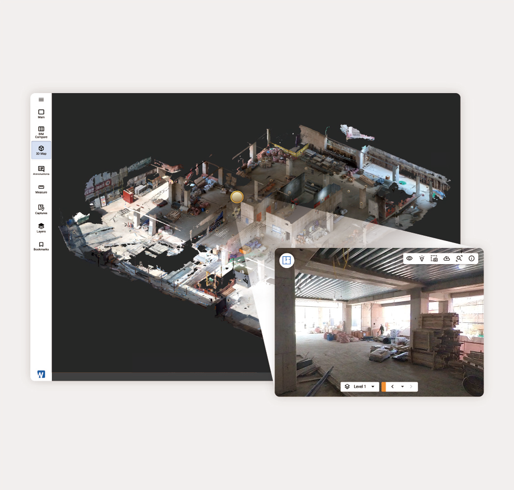
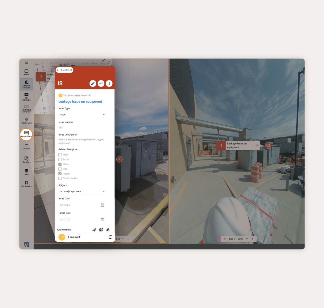
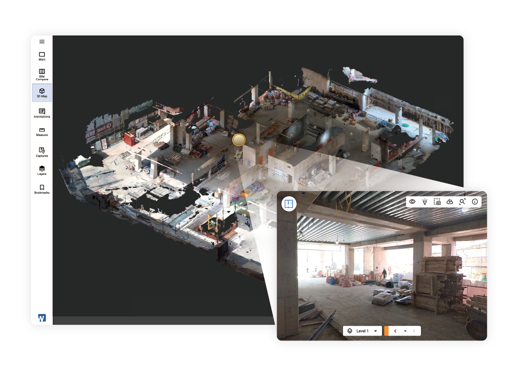
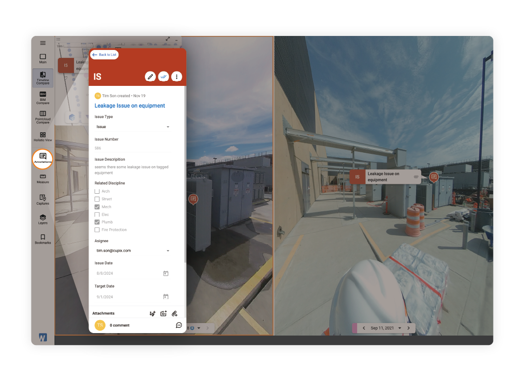
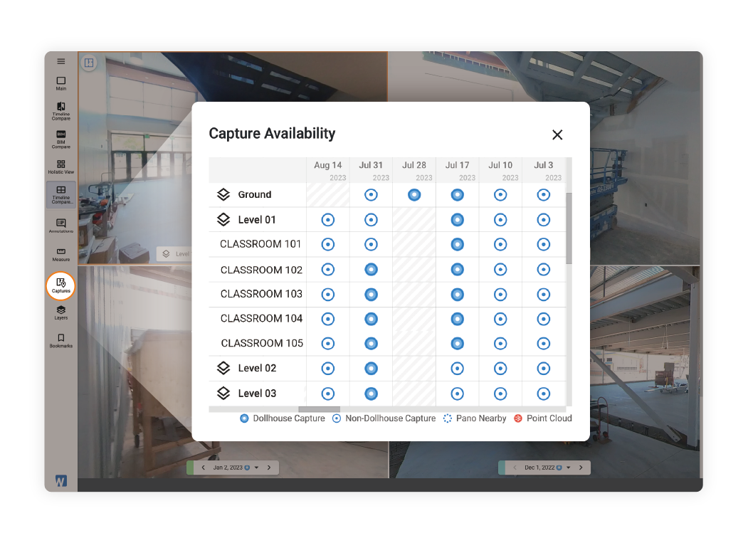
Transform your 360° videos into detailed 3D models using Cupix's AI technology. Beyond standard virtual tours, this tool lets you regularly capture and track spatial changes over time, creating a four-dimensional record of your site. View your project from above, take precise measurements of existing structures, and work with your team using BIM data, notes, and issue tracking—all accurately positioned and time-stamped in 4D space.
Learn more

Easy Yet Versatile

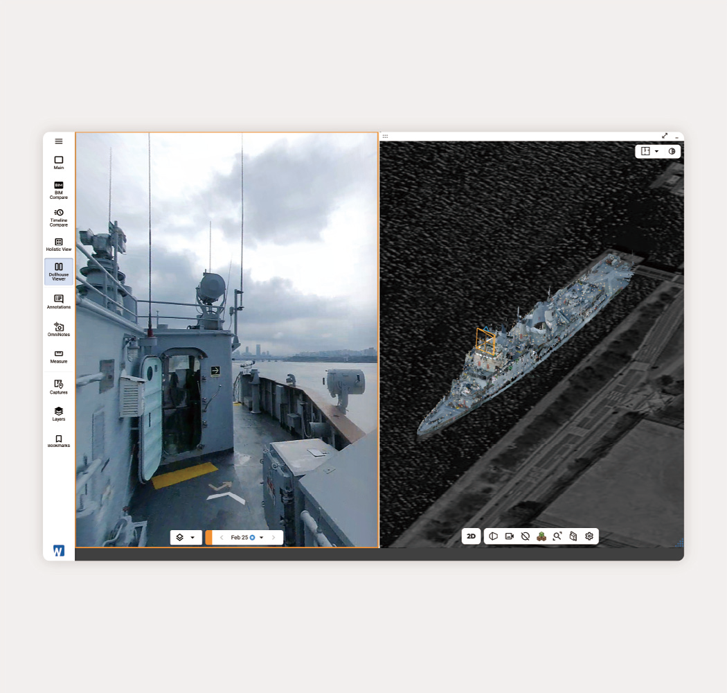
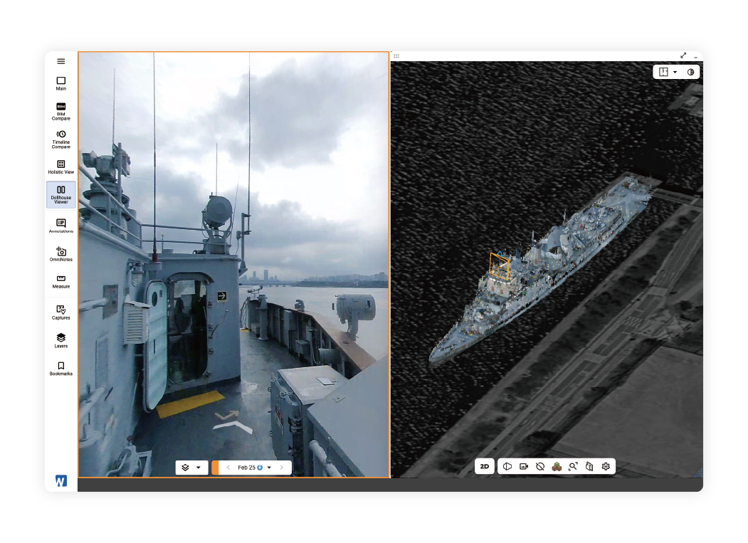
Whether taken from construction sites, miles of railway, entire commercial buildings, massive oil and gas plants, or complex vessel interiors, our AI transforms 360° videos into detailed 3D spaces you can measure and analyze.
Learn more

Understand Spatial Context without
Being There

Give your entire team perfect spatial understanding remotely - eliminate miscommunication, prevent rework, and make informed decisions without site visits.
Learn more

Record Spatial Changes for
Full Accountability

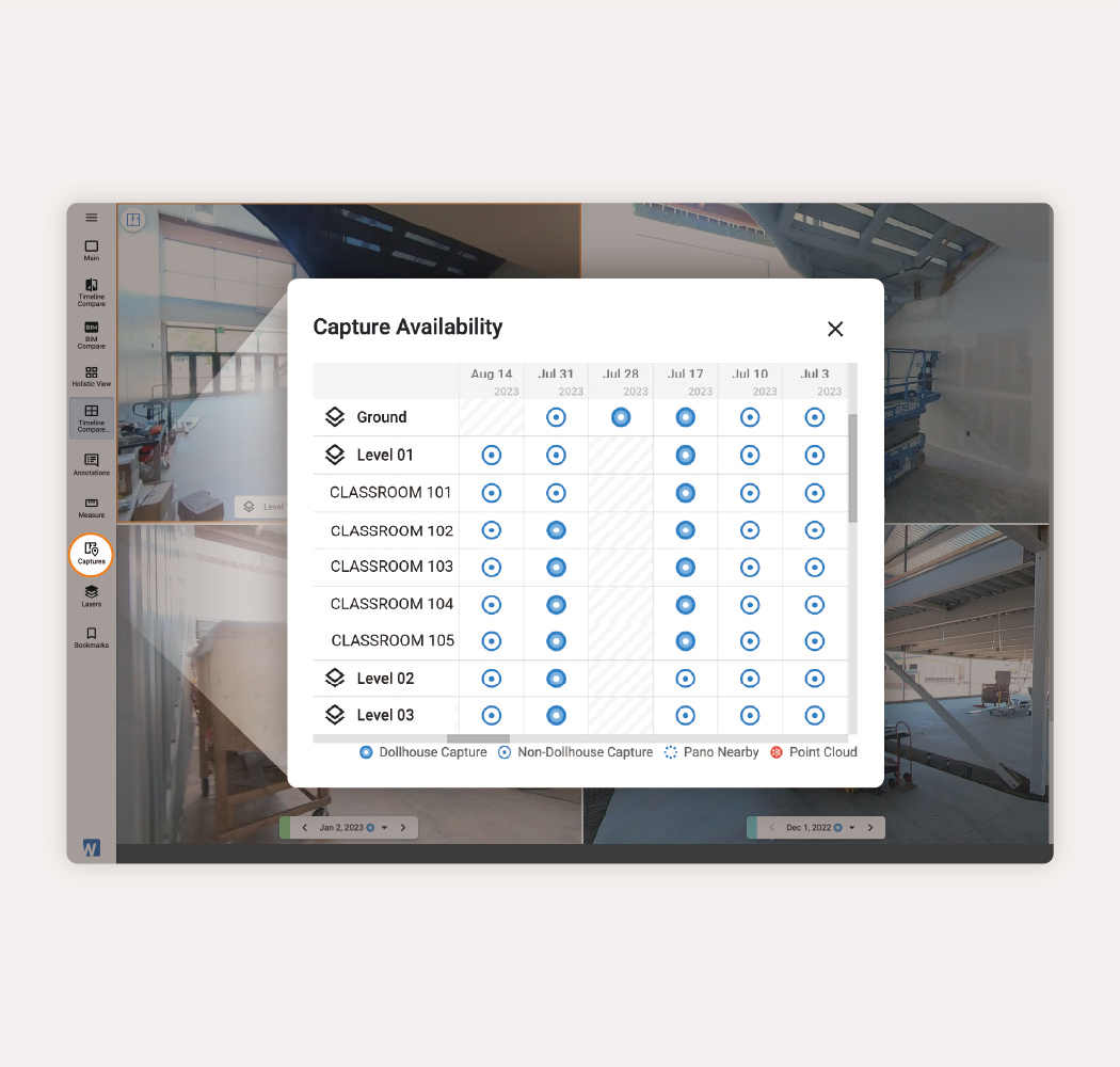
Ensure complete accountability with comprehensive as-built documentation—frequent 360° video walks replace thousands of photos, capturing both 3D spaces and their evolution over time for a complete 4D record, making it easy to track construction progress, verify work, and preserve documentation.
Learn more

Validate Work Against Design and Schedule

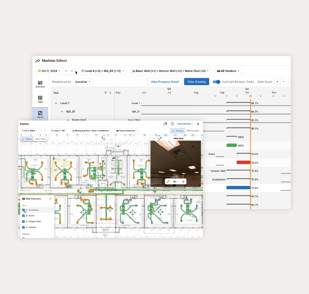
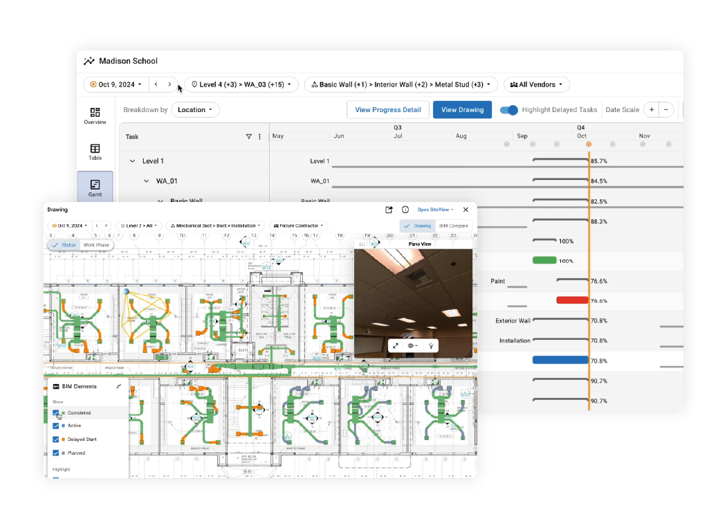
Our SiteInsights add-on automatically analyzes completion rates across work areas, trades, and BIM categories, turning 360° video site captures into actionable construction progress reports, helping teams stay on time and budget.
Learn more

Unify All Spatial Data:
Laser Scans, Drone Orthos, BIM in One Place

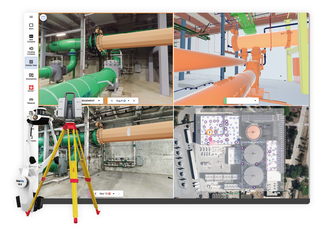
Cupix unifies all your reality data—from 3D maps converted from 360° videos and laser scans to drone imagery and BIM models—in one coordinated digital twin platform, eliminating the complexity of multiple applications and making your digital assets more valuable through streamlined collaboration.
Learn more

Seamlessly Integrates with BIM360, Autodesk Forma, Procore, Revizto, Oracle, and More

Seamlessly integrate and exchange critical project data between Cupix and your essential built-world platforms—including Autodesk BIM360, Autodesk Forma, Revizto, Oracle and ArcGIS—ensuring smooth workflows and consistent information across your entire digital ecosystem.
Learn more

Complete 4D Reality from Simple 360° Video Recording

Transform your 360° videos into detailed 3D models using Cupix's AI technology. Beyond standard virtual tours, this tool lets you regularly capture and track spatial changes over time, creating a four-dimensional record of your site. View your project from above, take precise measurements of existing structures, and work with your team using BIM data, notes, and issue tracking—all accurately positioned and time-stamped in 4D space.
Learn more

Easy Yet Versatile

Whether taken from construction sites, miles of railway, entire commercial buildings, massive oil and gas plants, or complex vessel interiors, our AI transforms 360° videos into detailed 3D spaces you can measure and analyze.
Learn more

Understand Spatial Context without
Being There

Give your entire team perfect spatial understanding remotely - eliminate miscommunication, prevent rework, and make informed decisions without site visits.
Learn more

Record Spatial Changes for
Full Accountability

Ensure complete accountability with complete as-built documentation—frequent 360° video walks replace thousands of photos, capturing both 3D spaces and their evolution over time for a complete 4D record, making it easy to track progress, verify work, and preserve documentation.
Learn more

Validate Work Against Design and Schedule

Our SiteInsights add-on automatically analyzes completion rates across work areas, trades, and BIM categories, turning 360° video site captures into actionable construction progress reports, helping teams stay on time and budget.
Learn more

Unify All Spatial Data: Laser Scans, Drone Orthos, BIM in One Place

Cupix unifies all your reality data—from 3D maps converted from 360° videos and laser scans to drone imagery and BIM models—in one coordinated platform, eliminating the complexity of multiple applications and making your digital assets more valuable through streamlined collaboration.
Learn more

Seamlessly Integrates with BIM360, ACC, Procore, Revizto, Oracle, and More

Seamlessly integrate and exchange critical project data between Cupix and your essential built-world platforms—including Autodesk BIM360, ACC, Revizto, and ArcGIS—ensuring smooth workflows and consistent information across your entire digital ecosystem.
Learn more
70%
Time & Efficiency Gains
Average reduction in site visits, reporting time, and design iterations
90%
Accuracy & Quality
Average improvement in data accuracy and design compliance
85%
Business Impact
Average improvement in business metrics and client retention
65%
Operational Efficiency
Average reduction in manual processes and workflow improvements
Use Case

End-to-End 4D Digital Twin Platform

See how industry leaders streamline their entire workflow—from reality capture to design integration, team collaboration, instant insights, and project archival—with our complete 4D digital twin platform.
30+
Projects Implemented
Successfully deployed across small works, refurbishments, and new builds.
100%
Project visibility
Complete transparency across all construction sites for executives.
Read Story
Bring the Virtual and
Physical World Together
100%
Reduction in site visits
Enabled offshore teams to effectively collaborate without physical site visits.
54%
Design Verification Efficiency
Faster design iterations through accurate comparison between designed and built elements.
Watch Video
ARCADIS Australia - Delivering
better construction outcomes
6x
Return on Investment
Achieved 6X ROI through implementation of Cupix technology for construction management.
50%
Reduction in site visits
Decreased on-site visits through remote access and virtual walkthroughs.
Read Story
Parc Olympique Renovation
85%
Time Reduction
Field report creation time reduced from 3 hours to just 20 minutes through digital documentation.
98%
Accuracy Rate
Achieved with 360 video generated point cloud for site documentation and planning.
Read Story
Brandt - Southland Expands Business Nationally by Embracing New Construction Technology
News and Media

Stay Ahead with Latest Updates

Explore our growing collection of e-books, feature updates, case studies, and industry insights. Discover how leading companies are transforming construction with CupixWorks and get inspired by their success stories.
No items found.
See what Cupix can do for you.

ENterprise Spatial Intelligence

Turn 360° Video into
End-to-End Spatial AI with Our Digital Twin Platform

Join thousands of global leaders across construction, oil & gas, manufacturing, and government who use Cupix to digitize their physical sites. From reducing site visits to tracking changes and validating work, our 4D digital twin platform helps teams share spatial context and maintain complete site records.
BIM deviations detected

Across the built world

Top general contractors, owners, and operation detect, align, and protect with Cupix every day.

Complete 4D Reality from  Simple 360° Video Recording

Transform your 360° videos into detailed 3D models using Cupix's AI technology. Beyond standard virtual tours, this tool lets you regularly capture and track spatial changes over time, creating a four-dimensional record of your site. View your project from above, take precise measurements of existing structures, and work with your team using BIM data, notes, and issue tracking—all accurately positioned and time-stamped in 4D space.
Learn more

Easy Yet Versatile

Whether taken from construction sites, miles of railway, en, massive oil and gas plants, or complex vessel interiors, our AI transforms 360° videos into detailed 3D spaces you can measure and analyze.
Learn more

Understand Spatial Context without Being There

Give your entire team perfect spatial understanding remotely - eliminate miscommunication, prevent rework, and make informed decisions without site visits.
Learn more

Record Spatial Changes for Full Accountability

Ensure complete accountability with comprehensive as-built documentation—frequent 360° video walks replace thousands of photos, capturing both 3D spaces and their evolution over time for a complete 4D record, making it easy to track construction progress, verify work, and preserve documentation.
Learn more

Validate Work Against Design and Schedule

Our SiteInsights add-on automatically analyzes completion rates across work areas, trades, and BIM categories, turning 360° video site captures into actionable construction progress reports, helping teams stay on time and budget.
Learn more

Unify All Spatial Data:
Laser Scans, Drone Orthos, BIM in One Place

Cupix unifies all your reality data—from 3D maps converted from 360° videos and laser scans to drone imagery and BIM models—in one coordinated digital twin platform, eliminating the complexity of multiple applications and making your digital assets more valuable through streamlined collaboration.
Learn more

Seamlessly Integrates with BIM360, Autodesk Forma, Procore, Revizto, Oracle, and More

Seamlessly integrate and exchange critical project data between Cupix and your essential built-world platforms—including Autodesk BIM360, Autodesk Forma, Revizto, Oracle and ArcGIS—ensuring smooth workflows and consistent information across your entire digital ecosystem.
Learn more

Complete 4D Reality from  Simple 360° Video Recording

Transform your 360° videos into detailed 3D models using Cupix's AI technology. Beyond standard virtual tours, this tool lets you regularly capture and track spatial changes over time, creating a four-dimensional record of your site. View your project from above, take precise measurements of existing structures, and work with your team using BIM data, notes, and issue tracking—all accurately positioned and time-stamped in 4D space.
Learn more

Easy Yet Versatile

Whether taken from construction sites, miles of railway, entire commercial buildings, massive oil and gas plants, or complex vessel interiors, our AI transforms 360° videos into detailed 3D spaces you can measure and analyze.
Learn more

Understand Spatial Context without Being There

Give your entire team perfect spatial understanding remotely - eliminate miscommunication, prevent rework, and make informed decisions without site visits.
Learn more

Record Spatial Changes for
Full Accountability

Ensure complete accountability with comprehensive as-built documentation—frequent 360° video walks replace thousands of photos, capturing both 3D spaces and their evolution over time for a complete 4D record, making it easy to track construction progress, verify work, and preserve documentation.
Learn more

Validate Work Against Design and Schedule

Our SiteInsights add-on automatically analyzes completion rates across work areas, trades, and BIM categories, turning 360° video site captures into actionable construction progress reports, helping teams stay on time and budget.
Learn more

Unify All Spatial Data:
Laser Scans, Drone Orthos, BIM in One Place

Cupix unifies all your reality data—from 3D maps converted from 360° videos and laser scans to drone imagery and BIM models—in one coordinated digital twin platform, eliminating the complexity of multiple applications and making your digital assets more valuable through streamlined collaboration.
Learn more

Seamlessly Integrates with BIM360, Autodesk Forma, Procore, Revizto, Oracle, and More

Seamlessly integrate and exchange critical project data between Cupix and your essential built-world platforms—including Autodesk BIM360, Autodesk Forma, Revizto, Oracle and ArcGIS—ensuring smooth workflows and consistent information across your entire digital ecosystem.
Learn more
Enterprise-grade spatial intelligence, at global scale
Customer evidence

Trusted at scale.
Proven on site.

Trusted by 70% of the ENR Top 30 General Contractors, Cupix has rapidly scaled to capture over 20,000 project sites globally since 2023, using AI to verify more than 1 million as-built BIM elements every single day.
70%
Time & Efficiency Gains
Average reduction in site visits, reporting time, and design iterations
90%
Accuracy & Quality
Average improvement in data accuracy and design compliance
85%
Business Impact
Average improvement in business metrics and client retention
65%
Operational Efficiency
Average reduction in manual processes and workflow improvements

Industries

Explore the Versatility of Cupix

See how leading organizations of diverse industries optimize construction and facility management.

Customer Stories

End-to-End 4D Digital Twin Platform

See how industry leaders streamline their entire workflow—from reality capture to design integration, team collaboration, instant insights, and project archival—with our complete 4D digital twin platform.
Explore Case Studies

Resources

Stay Ahead with Latest Updates

Explore our growing collection of e-books, feature updates, case studies, and industry insights. Discover how leading companies are transforming construction with CupixWorks and get inspired by their success stories.

Stop rebuilding the record every time the plan changes.

Book a demo to see how Cupix automatically connects your site captures to your latest designs, timelines, and operational assets.

The site copilot grounded in spatial intelligence

Ask what's there, what changed, and what's due.

Cupix connects captured reality with evolving design, schedule, and asset intent in one time-aware spatial record. Verify progress, investigate change, and act from evidence your team can locate and check.
BIM deviations detected
Enterprise-grade spatial intelligence, at global scale
Customer evidence

Trusted at scale.
Proven on site.

Trusted by 70% of the ENR Top 30 General Contractors, Cupix has rapidly scaled to capture over 20,000 project sites globally since 2023, using AI to verify more than 1 million as-built BIM elements every single day.
20,000+
Sites captured worldwide
Since 2023
1M+/Day
As-built BIM elements
Verified daily
70%
of ENR Top 30 GCs
Trust Cupix
Enterprise Spatial Intelligence

The trusted record for the built world

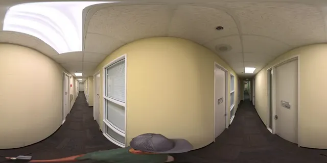
Capture any physical site effortlessly using 360° video. Cupix AI fuses real-world site conditions with your latest BIM models, schedules, and facility asset data to generate spatial intelligence, surfacing risks early and delivering trusted data to human teams or AI agents via MCP.
As-built foundation
  • 360° Video

    360° Video

    Continuous walkthrough capture

  • Drone Mapping

    Drone Mapping

    Site-wide aerial coverage

  • Laser Scan

    Laser Scan (LiDAR)

    Massive-scale point clouds

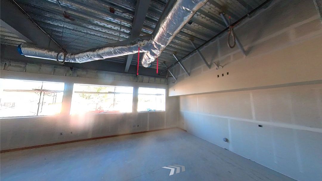
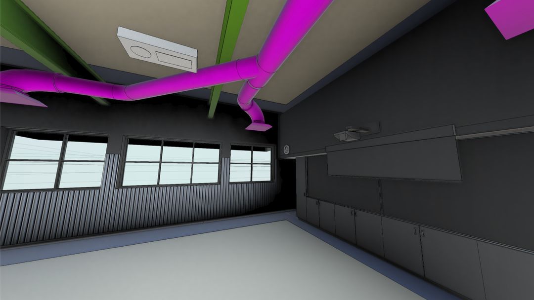
From CupixWorksCapture 2026.09.14Model rev 12
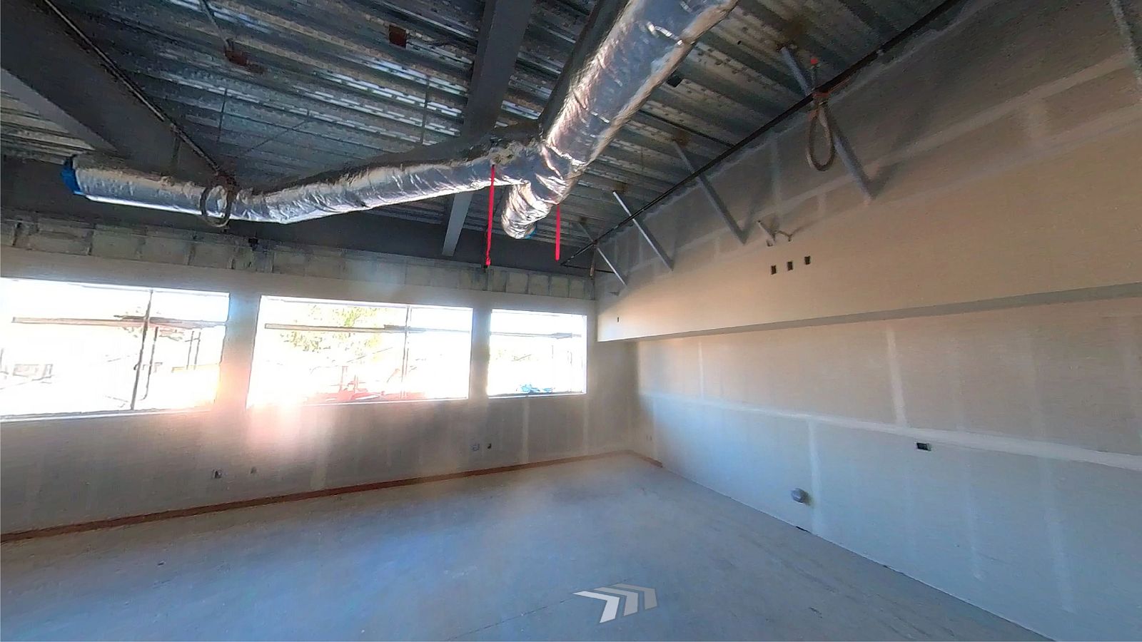
CupixWorks showing the as-built 360 capture of the space.
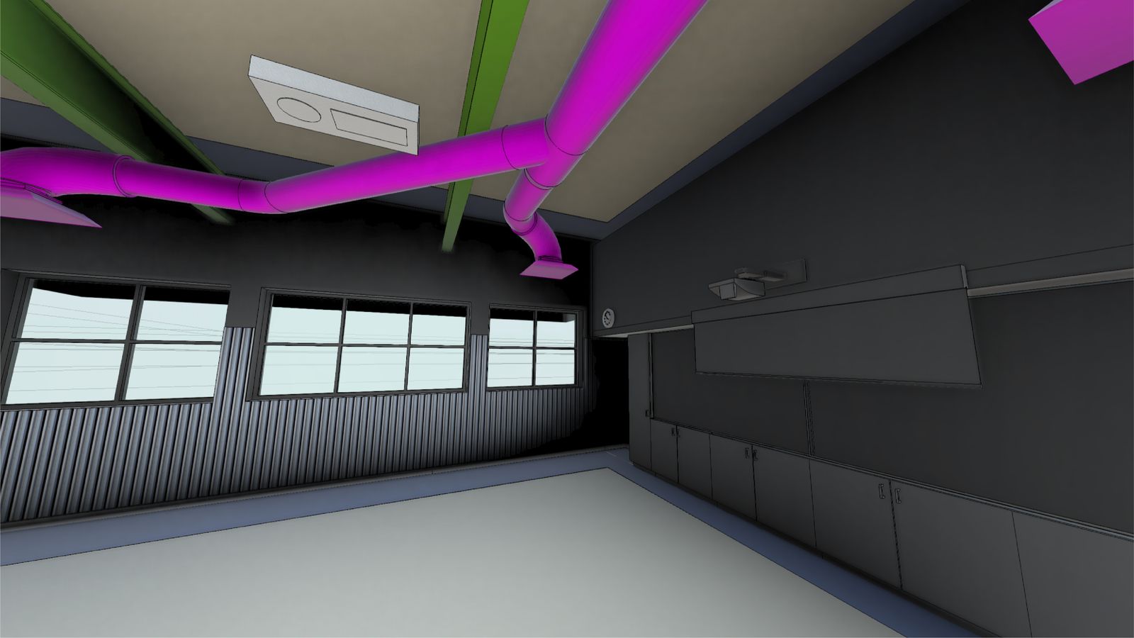
CupixWorks showing the BIM model at the same viewpoint. BIM intent
As-built 360°

Built condition against modelled intent.

Intent foundation
  • Design

    Autodesk Revit

    Design geometry & systems

  • Coordination

    Autodesk Navisworks

    Coordinated models & clash

  • Scheduling

    Oracle Primavera P6
    Sequencing & milestones

  • Planning

    Microsoft Project

    Schedules & task plans

  • Maintenance

    IBM Maximo

    Asset & maintenance records

  • ERP

    IFS

    Asset, ERP & service data

Detect.
Know what is where and
what changed.
Cupix turns routine captures and scan-scale data into a time-aware 3D record. Each observation keeps the place, height, source, and date that downstream decisions depend on.
Multimodal 3D SLAM

Capture a spatial record, not a photo trail.

CupixOmniSLAM combines 360 video, GPS, IMU, and mobile photos in a navigable, dimensionally anchored 3D as-built.
Explore As-Built Documentation
Capture and laser scan

Bring routine capture and scan data together.

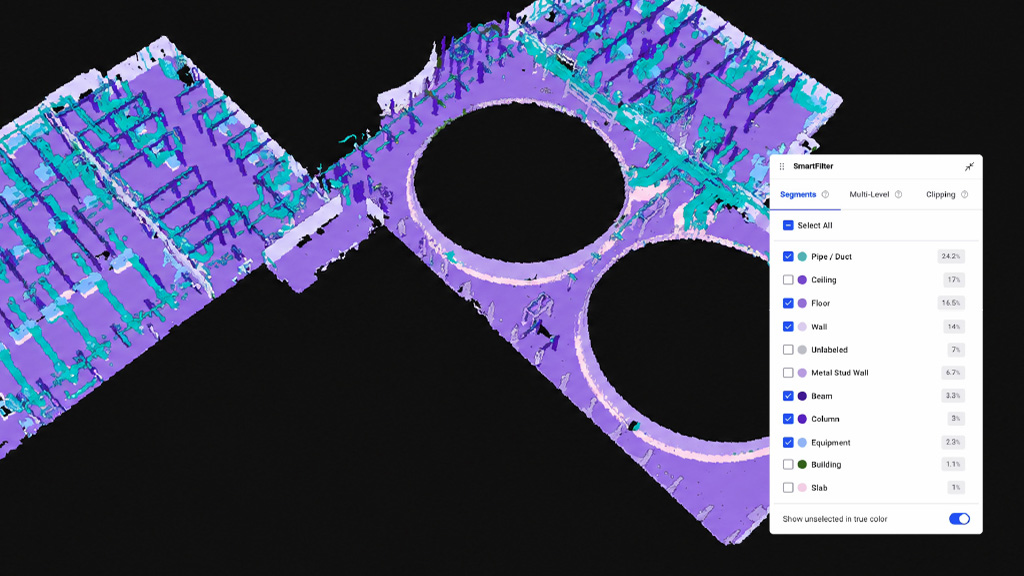
Low-light and tight-space captures, changing camera height, and large point datasets share the coordinate context used by BIM and schedules.
Explore SiteView
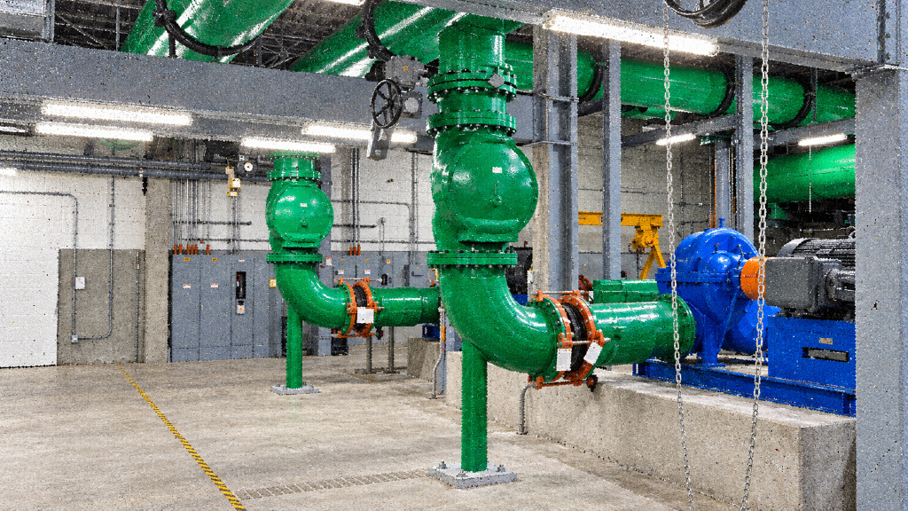
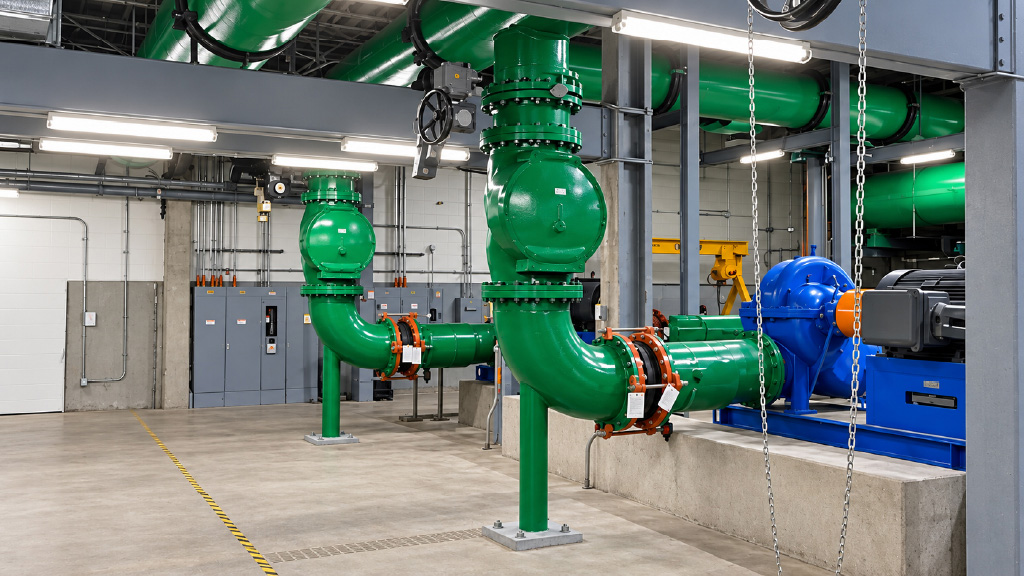
Point cloud reconstruction of a mechanical room 360 capture of the same mechanical room
Capture intelligence

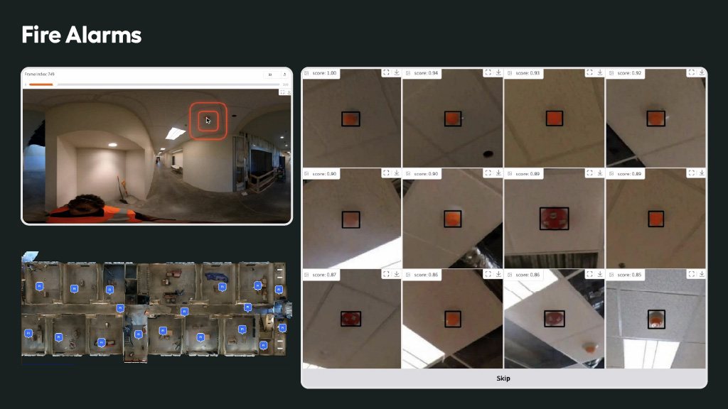
Turn every walk into located evidence.

Capture Intelligence surfaces findings while Custom Object Locator creates identified records that can be followed across captures.
Explore Capture Intelligence
Align.
Know what should be
there by now.
Move from a question to its cited source, bring that context to the field, and keep asset history useful after handover.
Installation verification

Verify installed progress against the plan.

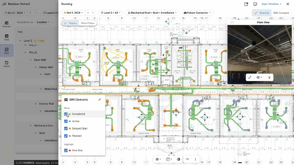
SiteInsights uses schedule-aware BIM targets to verify installation by work area, with Oracle Primavera Cloud context in the same workflow.
Explore CupixField

Schedule-aware BIM targets

Installation by work area

Oracle Primavera Cloud context

Explore Construction Progress Tracking
Illustrative multimodal capture of an unfinished building.
Revision continuity

Keep current intent in view as revisions arrive.

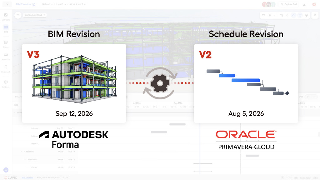
Design and Schedule File Transformation bring revised BIM and P6 data into the record. BIM Timeline keeps the dated planned state visible as that intent changes.
Explore CupixField
BIM deviation

Investigate deviation where it occurs.

DeltaBIM compares model and as-built conditions for structural concrete and MEP in the same spatial context used for follow-up.
Explore AssetAtlas
Act.
Ask the record.
Act from the evidence.
Move from a question to its cited source, bring that context to the field, and keep asset history useful after handover.
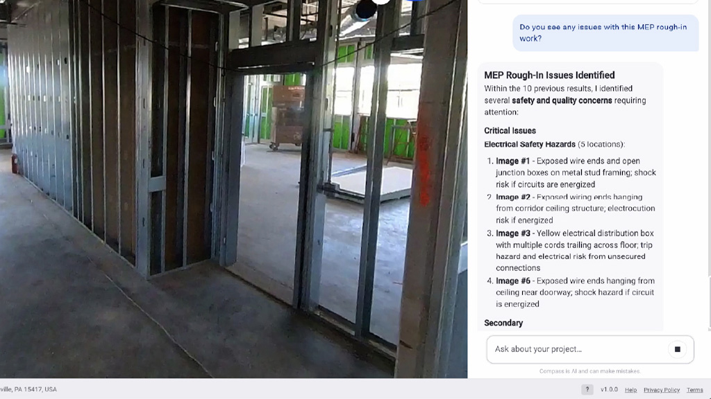
Compass and Cupix MCP

Ask across reality and intent.

Compass answers across site reality, BIM, schedule, safety, quality, objects, assets, and time, with citations and deep links. Cupix MCP exposes the same record to external AI agents.
What's installed above the ceiling on level 2?
What changed in this room since last month?
What should be installed here by now?
Explore Compass and Cupix MCP
CupixField

Stand in the context of the decision.

CupixField aligns BIM, past captures, SpatialNotes, and assets with where the field user is standing and looking.
Explore CupixField
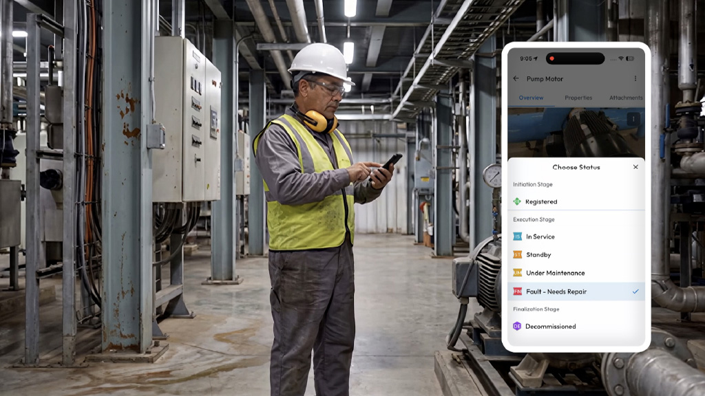
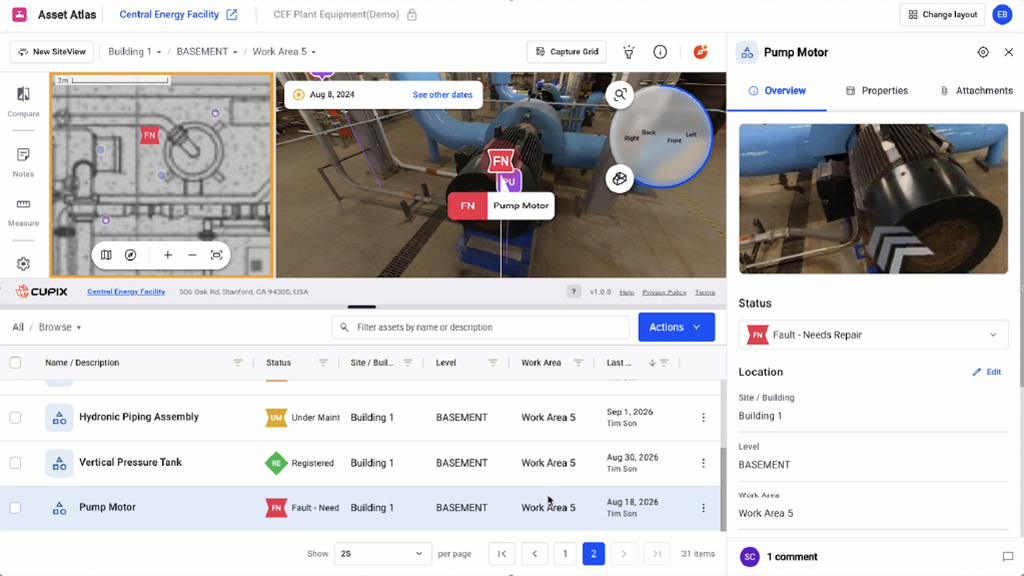
AssetAtlas

Carry the record into operations.

AssetAtlas keeps asset identity, location, condition context, and construction history connected after handover.
Explore AssetAtlas
Lifecycle continuity

Start with today’s priority. Keep the same spatial record forever.

Enter Cupix through the priority that matters today. Expand into the same spatial record as your needs move from construction to operations.
Project delivery
Construction teams and schedulers
Verify progress against the current plan.
SiteInsights product view
Evaluate this path
BIM/VDC and QA/QC
Design and quality teams
Investigate deviation with source evidence.
SiteInsights product view
Evaluate this path
Field and safety
Site teams in active work areas
Evaluate this path
SiteInsights product view
Explore AssetAtlas
‍Owners and operations
Facilities and asset teams
Keep asset history current after handover.
SiteInsights product view
Evaluate this path
Enterprise and portfolio
Executives and IT leaders
Standardize the site record across every location.
SiteInsights product view
Evaluate this path
AI and technology
CIO, CAIO, architecture, and technical teams
Ground enterprise AI in physical context.
SiteInsights product view
Evaluate this path
Enterprise Spatial Intelligence

One record. One license.
Kept current through revisions.

Bring captured reality, design, schedules, and asset history together under one Cupix license. Update the record as designs and schedules are revised, keeping reality and intent connected for teams and AI.

Every observation keeps its place, source, and date.

01 / Teams Project teams Verify · investigate · act
02 / Systems Enterprise systems Design · schedule · operations
03 / Agents AI agents Spatial context through MCP

Stop rebuilding the record every time the plan changes.

Book a demo to see how Cupix automatically connects your site captures to your latest designs, timelines, and operational assets.