
%401x.png)
CupixWorks brings 3D context to 2D capture to give you the best of both worlds.
AECO professionals know the value of gathering real-world data throughout the building lifecycle. A digital twin is key to this, enabling teams to collaborate more effectively, make better decisions, optimize processes, apply analytics, and reduce surprises. Most of all, access to real-world data via a digital twin protects profits in an industry with razor-thin margins.
Until recently, AECO professionals faced a problem—solutions for capturing real-world data for a digital twin were extremely limited. You could choose a platform built for photo or video capture, or a solution built around 3D scanning—the former focusing on speed, the latter on quality. No solution could bridge the gap between the two solution types and provide both speed and quality.
CupixWorks bridges the gap between speed and quality.
Low-cost platforms for photo or video site capture
To look at how CupixWorks does this, let’s start by examining platforms that use photo or video capture for documenting construction progress. There are definite benefits and downsides with this kind of process, making it a robust but imperfect solution for updating your project’s digital twin.
Benefits
- Low cost, especially compared to more sophisticated tools like lidar
- Simple to use, making it easy for any project stakeholders to perform capture
- Fast, since all you need to do is snap a few photos or take a video as you walk through a space
- Data is good for quick visual reference
Downsides
- Data is lower quality, owing to the limitations of the hardware and the speed of capture
- Accuracy of measurements is often unclear, making them unreliable
- No spatial context, with images plotted against a 2D floorplan instead of 3D space, which prevents comparison with pre-existing 3D models such as BIM
Summary
Platforms built for low-cost 2D capture are a compelling option because they make it easy and efficient for AECO professionals to update their digital twin frequently throughout the building lifecycle. But they do this at the expense of quality and spatial context, limiting the project’s ability to combine the data with 3D models for advanced applications.
Platforms for high-cost 3D site capture
Then there are the platforms that rely on high-cost terrestrial or mobile lidar scanners for capture.
Benefits
- Accurate data, as the capture is incredibly dense and detailed
- Native 3D from inception, providing precise x, y, z coordinates for every data point and allowing easy comparison with existing 3D models
Downsides
- Technology is expensive, with even the most affordable options costing significantly more than cameras
- Capture requires training and expertise, making it impossible for all stakeholders to use
- Data capture is difficult and time consuming, requiring high-powered computers to complete, and limiting access to the information
- Quality of the 2D images captured by these devices can be low, making it more difficult to use captured data for a quick visual reference
Summary
Laser scanning produces higher-quality, richer data than 2D capture, and comes with spatial context built in. This makes it possible for projects to perform a wider range of applications with their data. But the technology is much more costly and difficult to use—so it prevents projects from capturing frequently enough to provide ongoing data during the construction lifecycle.
A third option: bridging the gap
This situation left AECO professionals stuck when they wanted to capture real-world data through the building lifecycle. Do you use a platform built for photos and video, which enables frequent capture but makes it difficult to trust measurements, and prevents you from combining the data with your 3D models? Or do you use a platform built for lidar, taking advantage of the reliable measurements and spatial context it offers, but then capturing much less frequently?
CupixWorks offers a complete option. It enables you to capture photos, video, or laser scans, bring them into the same platform and view them together in the same 3D spatial context. You can have the best of both worlds.
When cameras are used to capture images on site, the solution applies proprietary processing to place each image in 3D space using a data structure inspired by Revit. This is in contrast to solutions that lay the photos out flat on a floor plan. CupixWorks automatically correlates your 2D and 3D data with single-pixel precision, opening up a variety of applications that were previously impossible with photo and video capture.
With CupixWorks, you can perform a quick visual clash detection by navigating to a specific spot in your BIM model and automatically pulling up the pertinent images with single-pixel, laid out in 3D space. If you want to learn if a duct is where it’s supposed to be, the platform makes it easy to find out.
You can also use CupixWorks to take precise and accurate measurements. Draw a line between two points, and the tool will triangulate the distance with known measurements for scale. With this function you can quickly check the height of a window or the distance between a door and a fixture.
The platform doesn’t just offer the best of both worlds—it improves on both options. Its unique ability to extract 3D intelligence from photos also enables you to compare time-series data, from images taken days or weeks apart. Since the platform has the spatial data on where each photo was taken, you can compare them easily and get a quick visual check on any differences between the two. If you’re wondering if a subcontractor completed a task on time, CupixWorks lets you find out fast.
CupixWorks also offers a bubble mode, which enables you to “look around” from a point of capture, much like lidar-based data platforms. But since the data was captured with a 2D camera, you can open a bubble view in places where lidar won’t fit, like a small space behind the MEP or in a tight space above ceiling tiles.
Wrapping up
By adding spatial context to 2D data, CupixWorks delivers the best option for gathering building data to AECO professionals.
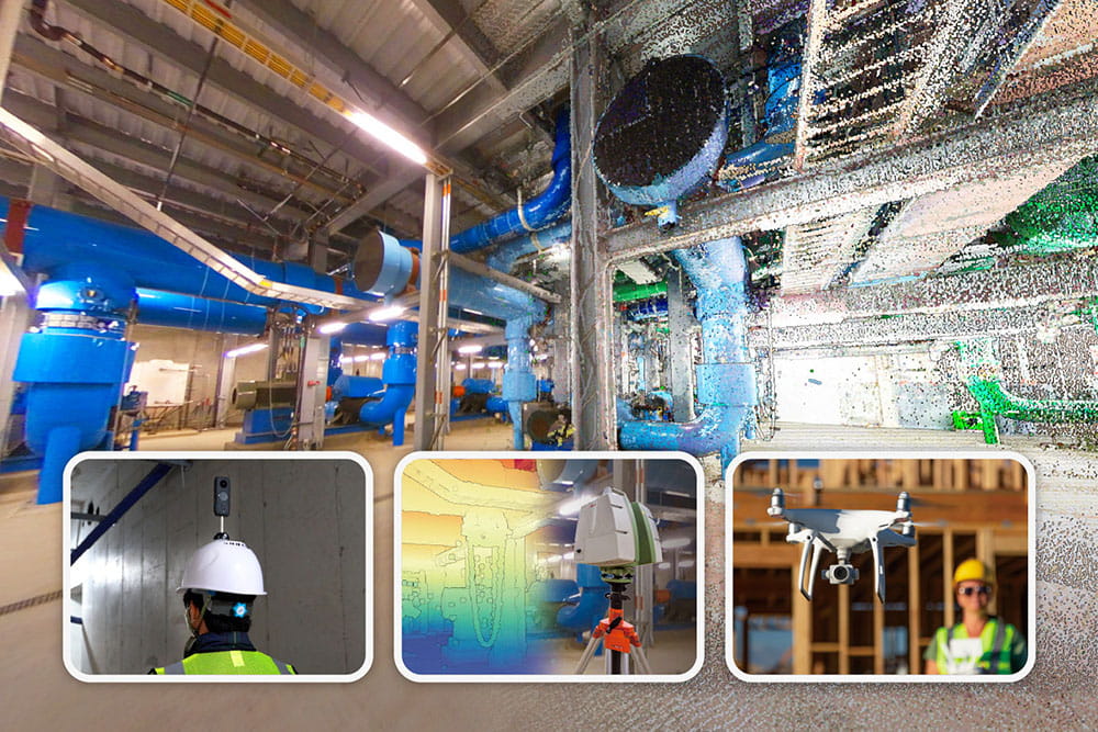
And the solution’s unified platform can ingest data from a multitude of sources—including 2D, 3D, and drones—as well as supporting robust BIM capabilities and features.
With CupixWorks you can build your project’s digital twin with data from any source, anywhere, anytime, and have a single source of truth across the whole building lifecycle.

