





Linear Infrastructure
4D Digital Twin for Linear Infrastructure
Linear infrastructure projects shape the backbone of modern connectivity, stretching across vast distances to link communities and power economies. From highways and railways to utility corridors, these extensive projects demand innovative digital solutions for documenting miles of construction while ensuring precise alignment and quality control. Digital twin technology has emerged as a game-changer in transforming how we capture, validate, and manage these critical infrastructure assets.
Request Demo
Challenge
What makes Linear Infrastructure challenging?
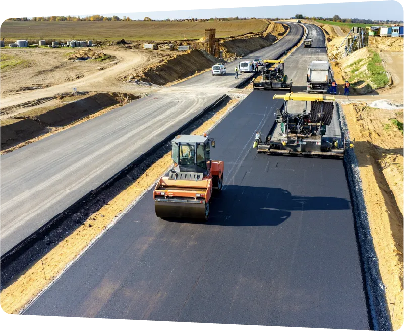
Constructing and documenting linear infrastructure presents unique complexities due to its geographical scale and distributed nature. Construction teams managing roads, railways, and utilities face unique documentation challenges due to the extensive scale and distributed nature of these projects. Traditional photo and video documentation methods often fail to provide consistent, organized records of site conditions.
Time-Consuming Documentation
Traditional site walks or manual photo documentation of infrastructure projects spanning miles is impractical and inefficient. Teams struggle to maintain consistent visual records across extensive project corridors.
Site Constraints
Remote locations, hazardous environments, and limited accessibility make regular site inspections and documentation challenging, potentially causing delays in decision-making and progress monitoring.
Limited Spatial Context
Scattered photo documentation makes it difficult to understand and share site conditions across extensive linear projects. Remote stakeholders lack clear visual context of how different sections connect.
Location Tracking
Without GPS integration, teams struggle to organize and navigate documentation for large linear sites effectively. This makes it challenging to locate specific sections when reviewing site conditions or sharing information.
Project
Linear Infrastructure Project
Type
Linear Infrastructure, Road Widening Project
Location
South Korea
Use Case
4D Documentation
Vehicle-mounted, GPS-enabled capture and documentation of vast sites.
Spatial Collaboration
Remote collaboration with stakeholders on remote site feasibility studies.
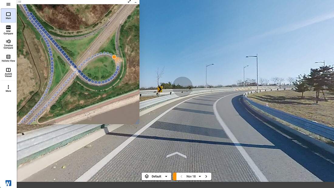
CupixWorks' VideoDrive feature enables GPS-enabled, vehicle-mounted 360° capture at speeds up to 40km/hr. This capability expands capture opportunities to sites that are too vast, long or dangerous for humans to walk such as linear infrastructure, large construction sites and wild sites.
Solution
Benefits of 4D Digital Twins for Linear Infrastructure
CupixWorks revolutionizes linear infrastructure documentation by enabling rapid capture and validation of extensive construction corridors. Our platform empowers teams to efficiently document miles of infrastructure while maintaining detailed records for construction verification and compliance requirements.
Transform vehicle-mounted 360° video into organized virtual site records for extensive infrastructure projects. Capture miles of roads, railways, and utilities efficiently while maintaining GPS-tagged visual documentation.
Document linear infrastructure at speeds of 20-30 km/h using vehicle-mounted 360° cameras. Complete site documentation in a fraction of the time compared to traditional photo captures or manual site walks.
Navigate captured site conditions using GPS coordinates to quickly locate and review specific sections. Share precise locations and site context with stakeholders through browser-based virtual tours.
Maintain structured visual documentation of your infrastructure projects with location data. Access past captures through an intuitive interface to review site conditions or reference for maintenance needs.
Enterprise-grade spatial intelligence, at global scale
10x
Faster Capture: Vehicle-mount capture dramatically reduces time to capture sites
5x
More Feasible: Vehicle-mount capture dramatically expands new opportunities for areas that are inaccessible, dangerous and too vast to walk by foot such as highway, pipeline, and railway
Stop rebuilding the record every time the plan changes.
Book a demo to see how Cupix automatically connects your site captures to your latest designs, timelines, and operational assets.
